| LATEST SEISMIC EVENTS RECORDED AND
DEVELOPED ON MY SEISMOGRAPH |
This seismograph location is about 50 Miles (80 km) north of San
Francisco near the coast
38.46511 N, -123.01406 W
PLEASE NOTE: Some images on this
page are full sized and spread over two monitors at 1920 x 1200
pixels each making the maximum image width 3830 pixels
To view the entire image, please use your
browser bottom slide bar
(left/right) to move across this 3400 pixel seismic image and the
browser right side slide bar
(up/down) to center the image.
List of images on this page:
1.
New Caledonia
2. Comparing
a horizontal to a vertical seismograph on the same even -
NOT COMPLETE!
Back to the main page |
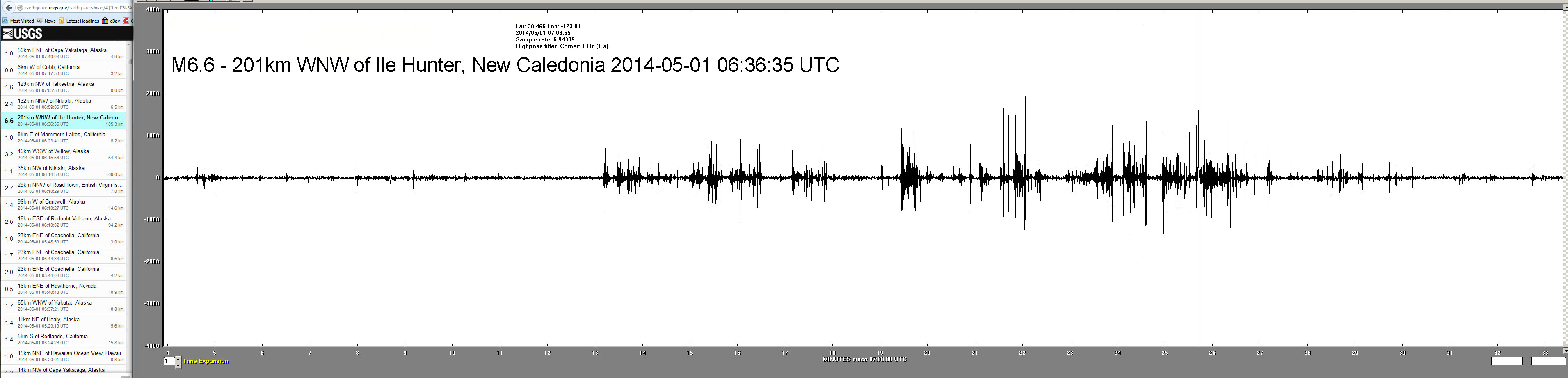
1.
New Caledonia
M6.6 - 201km WNW of Ile Hunter, New
Caledonia 2014-05-01 06:36:35 UTC |
EVENT TIME: 2014-05-01 06:36:35 UTC
Estimated time delay from my seismograph is 25
minutes or 07:10 as an arrival time
This event is about 6,200 miles (10,000 km)
from my seismograph.
IMAGE BELOW: |
|
2.
Comparing a horizontal to a vertical seismograph on the same
event |
This is a project yet to be completed.
I did have an image of an
international event but the vertical seismograph I am using
needs to be calibrated and then I will need to wait for new
fairlyy strong event. I will also probably move the data from
both events to a .sac file and display both events, the vertical
and the horizontal, on the same type of extraction screen so
there is a better "apples to apples" comparison.
As soon as all of this works I will display the results here.
|
Back to the main page
|